Kham Maps
Kham Region Map (Eastern Tibet)
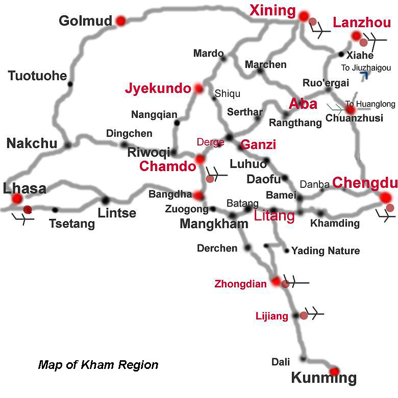
In the eastern part of Tibet, southeastern Qinghai and northwestern Sichuan in China, lays what used to be the Tibetan Province of KHAM, inhabited by the proud and fiercely independent Khampa tribes. To this day they are easy to recognize: their cheer size, long hair and traditional clothing separate them from other Tibetans.


More about Kham
When speaking of "Tibet", it means "Tibetan Autonomous Region" (TAR), with Lhasa as the capital. When speaking of "Tibetan Cultural Area", it means the areas traditionally inhabited by Tibetans, including the TAR and the areas of Kham and Amdo.
In the areas of Kham and Amdo - featured by precipitous snow-capped mountains, sparkling glaciers, vast pasture, deep river valleys - bordering provinces Sichuan,Yunnan, Qinghai and Gansu lives a group of ancient Tibetans.
Kham is composed of pieces of eastern Tibet Autonomous Region, western Sichuan, southeast Qinghai, and northwest Yunnan; Amdo - Qinghai, southwest Gansu and northwest Sichuan.
Because of some historical reasons, various sects, such as the "Red Sect", the "Striped Sect", the "White Sect", the "Black Sect" and the "Yellow Sect" that eventually developed within Tibetan Buddhism and the indigenous Tibetan religion known as Bon, have coexisted here and add radiance and splendor to one another, creating a unique Buddhist spirit that can only be found in this region.